
AirTrack API
Street-level air quality, personal exposure and cleaner routes through one REST API – the same engine that powers the AirTrack apps. Copy-paste examples in curl, Python and TypeScript take you from token to first call in minutes.
Every example comes in curl, Python and TypeScript, and the full OpenAPI spec is ready for your tooling or AI coding assistant.
Browse the API reference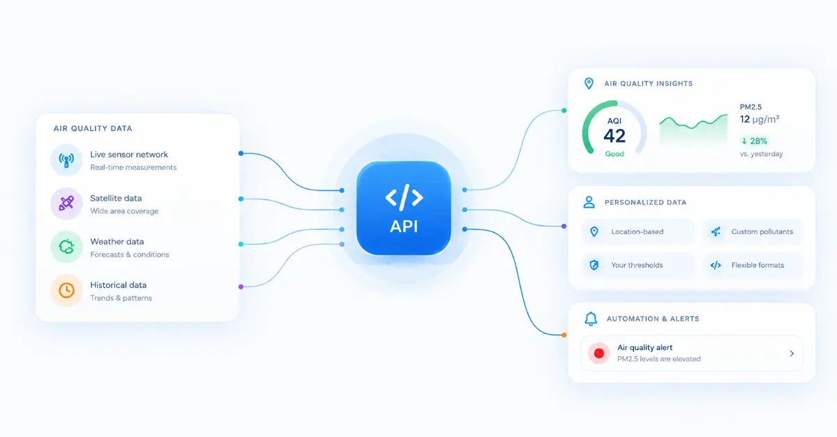
Get started by generating a pairing code in the AirTrack app (Settings->Connections->Pair a device) and your client swaps it for a token.
Send a location and get a Clean Air Score back, from 0 to 100 – higher is cleaner. One request, one credit.
Add forecasts, route enrichment and cleaner-route planning from the same credit pool, and check your balance any time.
Demo
Send a location with your token and the API returns the Clean Air Score for that spot, from 0 to 100, plus a TTL telling you when it is worth asking again. Every other endpoint follows the same shape.
curl -X POST "https://api.airawarelabs.com/v1/airquality/score" \
  -H "Authorization: Bearer $AIRTRACK_TOKEN" \
  -H "Content-Type: application/json" \
-d '{ "lat": 51.5074, "lon": -0.1278 }'{
"score": 82,
"ttl": 3600
}Endpoints and credits
Score a place, forecast a day, enrich a route or plan a cleaner one. All four draw on one shared monthly credit pool, so you can spend it however your product needs.
The Clean Air Score right now for any location, from coordinates or a Wi-Fi scan.
Hourly Clean Air Scores and pollutant levels for a place and date, so people can plan around the cleanest hours.
Per-waypoint air quality plus a route summary: Clean Air Score, relative inhaled dose and average pollutants.
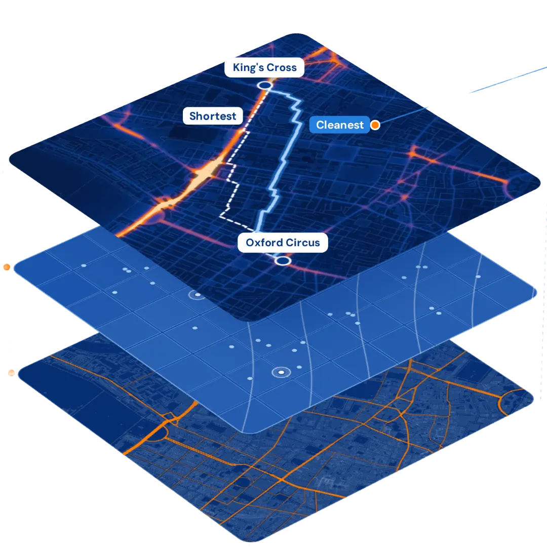
Lower-exposure walking, cycling and running routes between two points, each compared with the direct route.
Checking your balance, redeeming a pairing code and collecting a route plan are free. Calls that fail before delivering a result are refunded automatically, and validation errors are never charged. Apps and devices paired by an AirTrack Premium user share that user's 1,000 credits a month; partner accounts are usage-based, with volume discounts.
Sectors
One API, three places it makes a real difference. Pick yours to see what you can build.

For wearables, training platforms and activity apps – see our Garmin and Wings of Survival success studies.
.webp)
For digital health, clinical and wellbeing teams helping people manage asthma, COPD and heart conditions.
For mobility, cycling, walking and journey-planning products, and the cities behind them.
Fitness
Athletes inhale 10–20× more air than at rest, and they already track almost every part of their training. Add the missing metric – what they breathed – to your wearable, app or platform, automatically after every session.
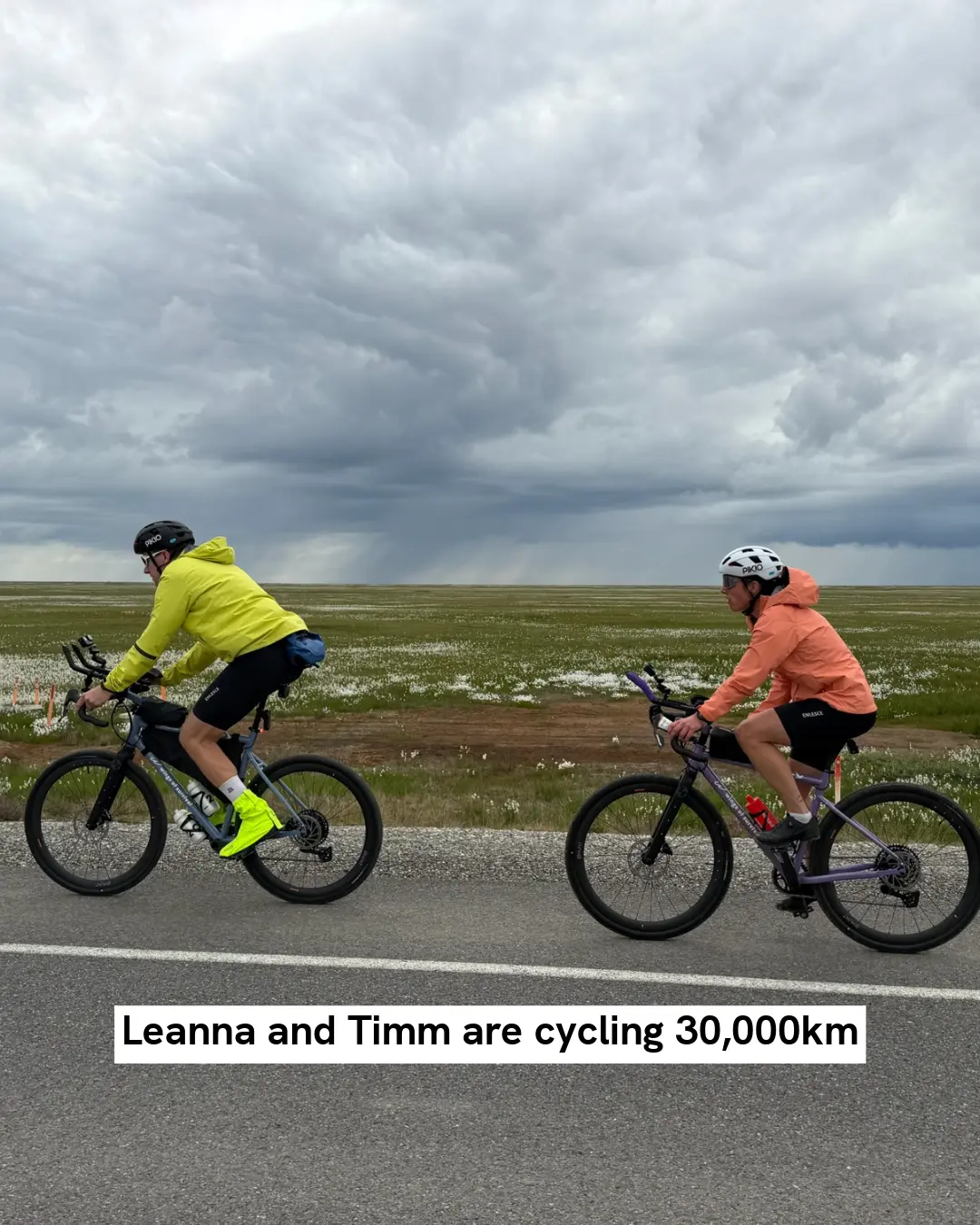
Timm Döbert and Leanna Carriere are cycling 30,000 km from the Arctic to Patagonia. Their expedition shows what the AirTrack engine can do for travel: every tracked ride becomes a private air quality breakdown along the GPS route, from empty tundra roads to towns and wildfire smoke.
.webp)
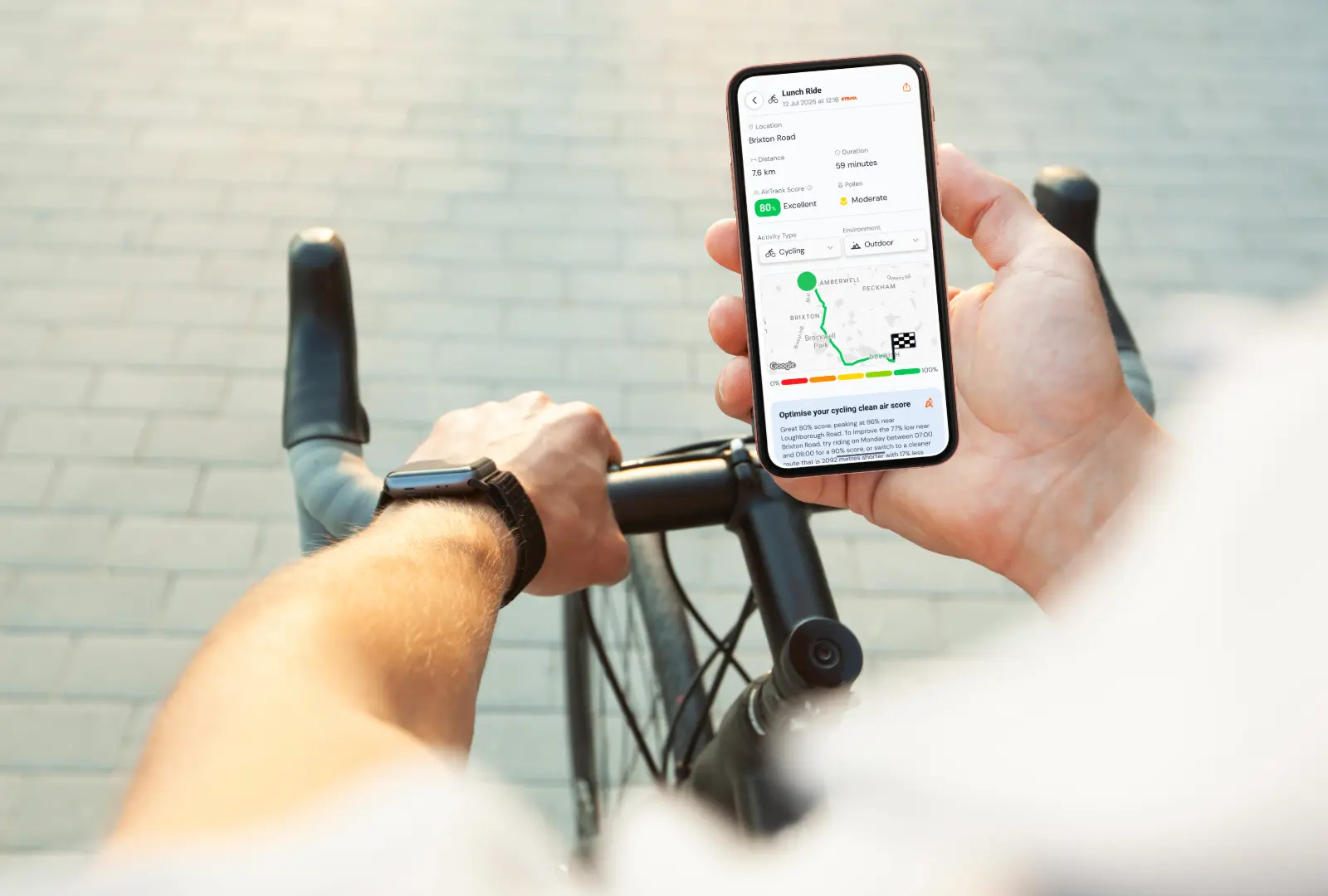
Runs, rides and walks recorded on Garmin come back enriched after every session: an AirTrack Score for the exact route and time, a pollutant breakdown and local pollen.
Send a recorded track to Enrich a route and get per-waypoint scores and a route summary back – ready to sit next to pace, heart rate and elevation in your own product.
Health
Symptoms rarely arrive with a pollution reading attached. Hourly forecasts and personal exposure help your product warn people early, and help clinicians see the patterns behind a flare-up.
Hourly Clean Air Score forecasts let your app nudge people with asthma or COPD towards the cleaner hours of the day.
Pair each symptom log with the air at that time and place, so patterns show up in the data rather than in hindsight.
Route scores adjust for activity and for indoor or outdoor settings, and estimate a relative inhaled dose – not just the reading outside.
Active travel
Walkers and cyclists breathe harder than people in cars, often right beside the traffic. A different street or a later start can cut exposure on the same journey by up to 30%.
Send a start and an end and get walking, cycling or running alternatives. Each one shows its extra distance next to the exposure it saves, so people can see when a detour is worth it.
Enrich the route someone already takes and show where the air gets better or worse, waypoint by waypoint.
Hourly forecasts show when the air on a commute is likely to be cleanest, so people can shift their start time as well as their route.
Tell us what you're building and we'll set up your access. Your first call takes minutes.