Wings of Survival AirTracks for International Day of Clean Air for Blue Skies

September 7, 2026
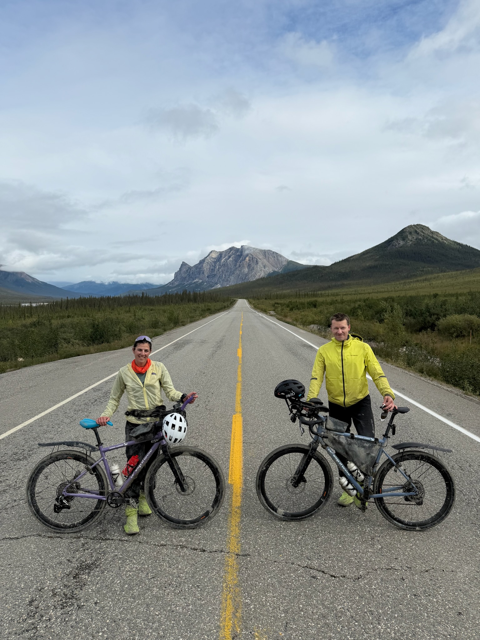
London, UK, 7 September 2026 – To mark this year's International Day of Clean Air for Blue Skies, Air Aware Labs, the company behind the AirTrack app, is sharing a month of modelled air quality data from its partnership with Wings of Survival, a nine-month, 30,000km cycling expedition from the Arctic to Patagonia. Across 3,884km and 28 riding days in August, spanning four distinct legs, the air changed with almost every stretch of road.
Timm Döbert and Leanna Carriere set off from Prudhoe Bay, Alaska on 1 August, retracing the migration route of two GPS-tracked whimbrels as they cycle south towards Tierra del Fuego. AirTrack is plugged into Strava, turning Timm's tracked riding hours into a private air quality breakdown, modelled along his GPS route rather than measured from a sensor on the bike.
August's ride is really four different stories. The Dalton Highway was about as clean as expected on Alaska's empty tundra roads. It got busier crossing the Alaska Highway into the Yukon, then cleared again on the 1,330km Cassiar Highway, the best air of the whole expedition so far. Then, in interior British Columbia, the particles tripled, and a stretch of road south of Prince George ran at three times the WHO guideline. That was wildfire smoke, checked against independent satellite data rather than assumed. Running underneath all four legs was a quieter thread: ozone climbed every single time, ending the month 98% higher than where it started, the one pollutant that never eased off.
Louise Thomas, CEO and co-founder of Air Aware Labs, said: "We started AirTrack because most people have no idea what they're actually breathing. Most of this ride stayed well within guidelines, but one stretch hit three times the limit when the smoke rolled in. That's exactly what we want people to see on Clean Air Day."
Dr. Timm Döbert, CEO and co-founder of Wings of Survival, said: " The Cassiar Highway gave us some of the cleanest air of the whole ride, and then the wildfires changed everything within a week. Seeing it mapped out like this makes the journey feel even more real."
Wings of Survival's ride south continues over the coming months, already moving between remote highways and towns like Whitehorse and Prince George, with more cities still to come. AirTrack will keep tracking every stretch, so the difference between quiet backroads, towns and wildfire smoke should keep showing up in the data as the journey unfolds.
For more information, visit wingsofsurvival.com or airawarelabs.com. Download AirTrack at https://airawarelabs.app/PRKit .
-ENDS-
About Wings of Survival
Wings of Survival is a nine-month, 30,000km cycling expedition from the Arctic to Patagonia, led by tropical ecologist Dr Timm Döbert and extreme athlete Leanna Carriere. The route retraces the migration of two GPS-tracked whimbrels, combining exploration, science and storytelling to inspire people to protect, conserve and rewild the planet.
About Air Aware Labs
Air Aware Labs is a London-based technology company founded in 2024. It builds AirTrack, an app that turns air quality data into simple, personal insights to help people understand their daily exposure.
Note to editors
- The 2026 International Day of Clean Air for Blue Skies falls on 7 September, with the theme "Clean Air Action".
- This year's campaign centres on the Global Economic Assessment of Integrated Climate and Clean Air Action, launched by UNEP and the Climate and Clean Air Coalition on the day, setting out 25 measures that improve health, economies and climate outcomes together.
- Air pollution is recognised by the World Health Organization as one of the leading global health risks affecting 99% of the global population and linked to an estimated 7 million premature deaths a year worldwide.
- Whimbrels are classed as Least Concern by the IUCN, but flagged as a "tipping point species": their global population has fallen by more than 80% in the last 50 years, driven by coastal wetland loss, tundra development and hunting pressure, according to the American Bird Conservancy and Manomet Conservation Sciences.
- Athletes inhale between 4-10 times more air pollutants as compared to someone at rest (Paul Day, 2024)
- 54% of habitual exercisers say they actively think about air quality during workouts and how it may affect their health, rising to 59% among people who train in urban areas (peer-reviewed research on attitudes towards air quality during outdoor exercise).
- Urban cyclists face elevated traffic-related air pollutant exposure due to proximity to emissions and increased breathing rates during exercise, with 29–50% of individuals changing exposure risk category once breathing rate is factored in (peer-reviewed exposure estimation research).
- AirTrack tracks five key pollutants (PM2.5, PM10, NO2, O3 and SO2) plus real-time pollen forecasts, and integrates with Strava, Apple Health and Google Health Connect. While most air quality tools focus on outdoor or city-level averages, AirTrack provides personalised, time- and location-specific exposure insights, combining indoor and outdoor environments to reflect how people actually move through their day.
.svg)