
AirTrack follows Wings of Survival into the Yukon

August 19, 2026

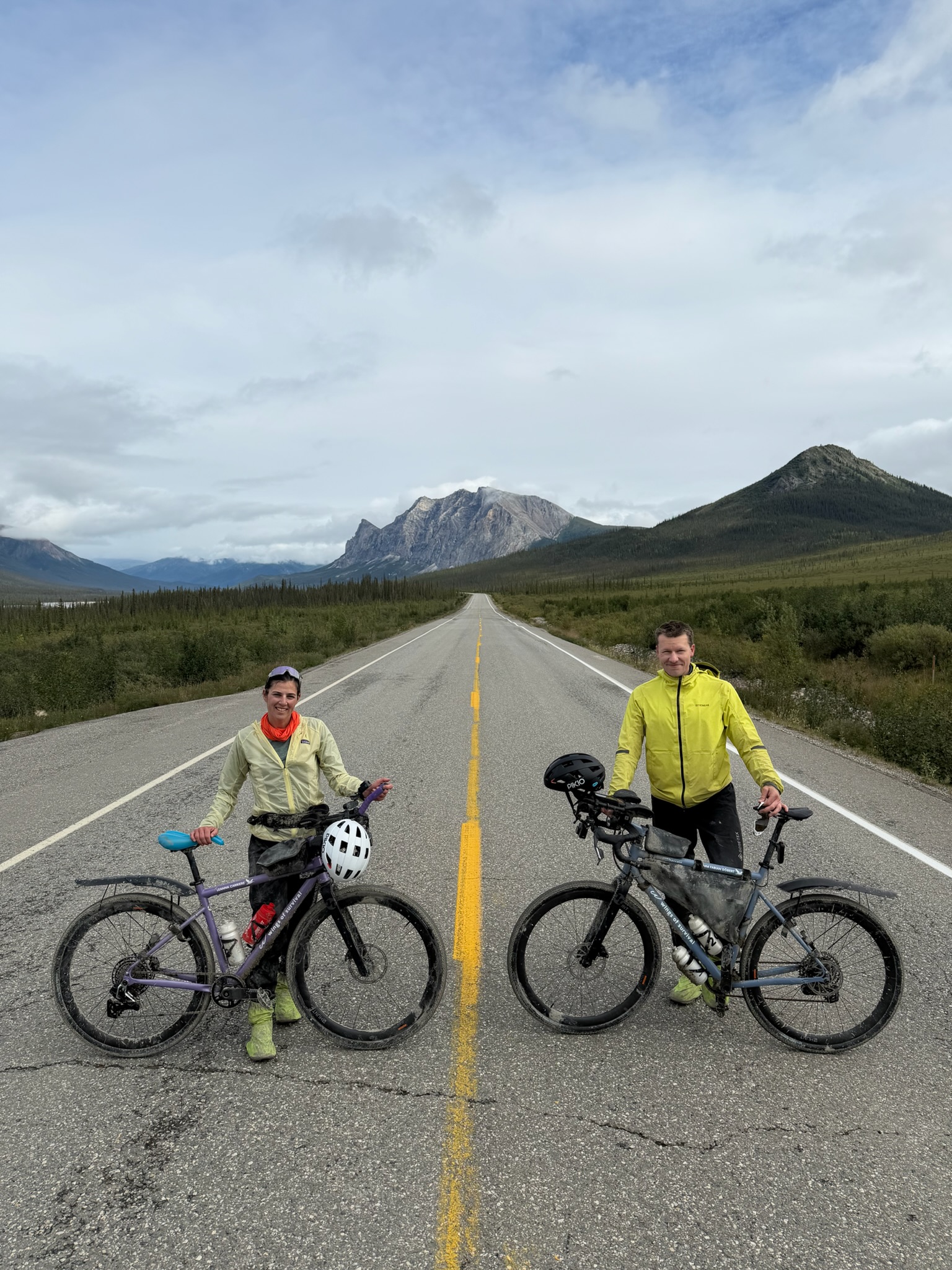
The pair are retracing the migration route of three GPS-tracked whimbrels, birds whose population has dropped by more than half in the last 50 years, as part of a mission to reconnect people with the natural world through adventure, science and storytelling.
Behind the scenes, Air Aware Labs has been tracking the air Timm and Leanna breathe throughout the ride. AirTrack is plugged directly into their Strava, turning every stretch of road into a private air quality breakdown.
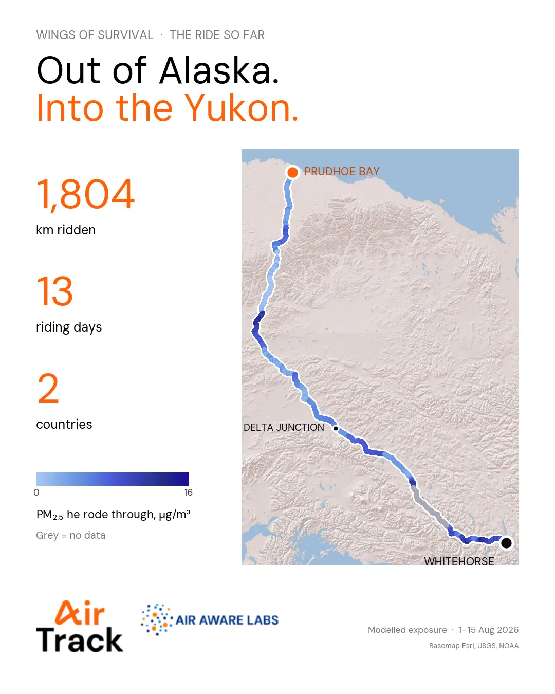
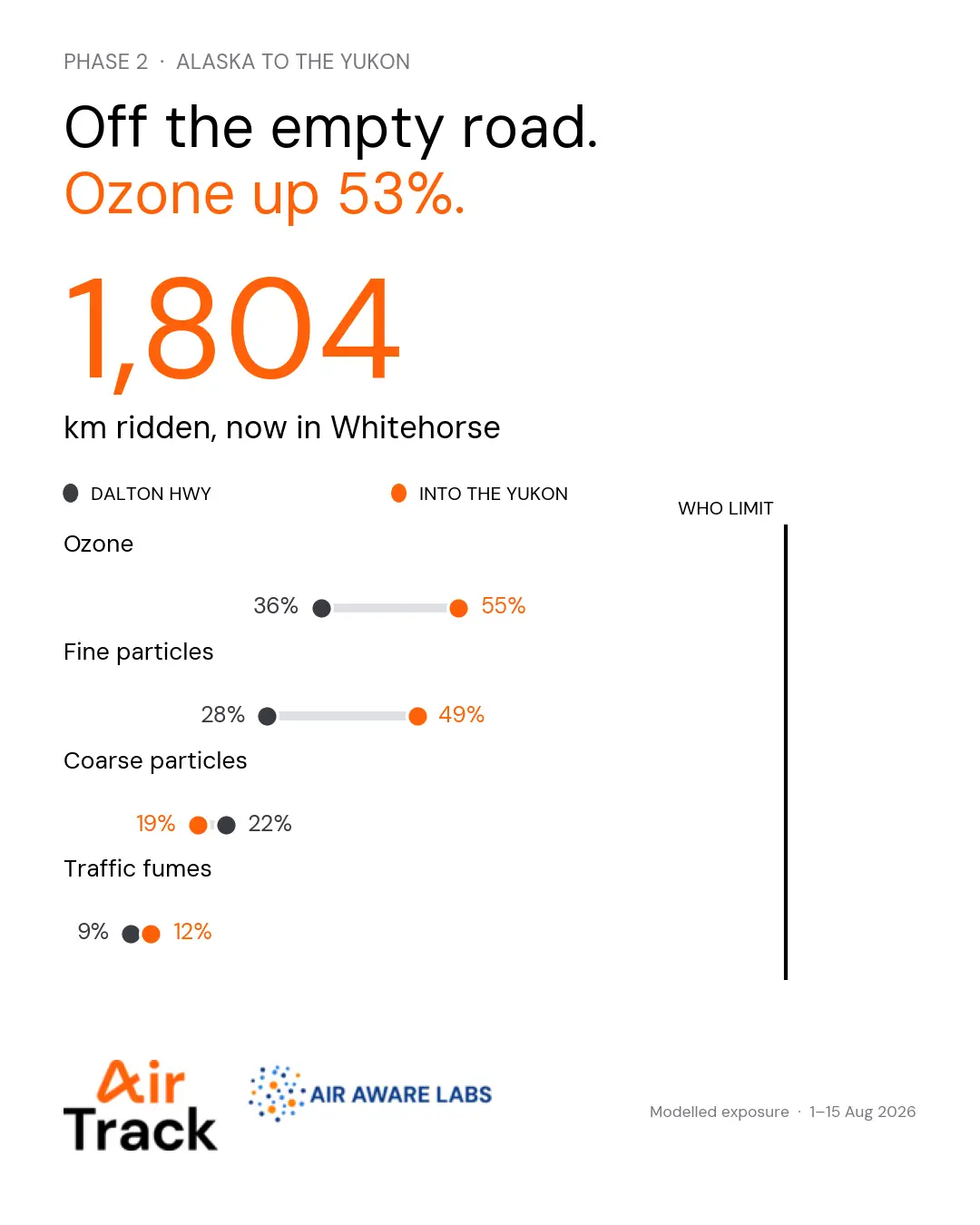
The latest numbers, covering the stretch from Alaska's Dalton Highway into the Yukon (1 to 15 August), tell a reassuring story: not one breath has crossed the WHO air quality guideline. But it isn't a flat line. As the empty highway gave way to more populated roads, exposure climbed: ozone is up 53%, from 36% of the WHO guideline on the Dalton Highway to 55% in the Yukon, with fine particles following a similar trend. Coarse particles and traffic fumes barely moved, so the shift looks like changing air along the route, not a sudden pollution spike.
It's early data from a nine-month journey, but it's exactly what this partnership set out to capture: a real, honest picture of the air two people breathe while doing something extraordinary for a cause worth protecting.
There's a lot more road ahead of Timm and Leanna, and a lot more air still to track. More to come as the journey continues!
.svg)


.png)